Fifty years ago, in 1973, the Arecibo Observatory in Puerto Rico provided scientists with an unprecedented view of Venus’ surface. This was made possible through a radar mapping project that used the massive Arecibo radio telescope to bounce radio waves off the planet’s surface and capture the returned signals. The project was the first of its kind and yielded a wealth of information about the hostile environment of Venus.
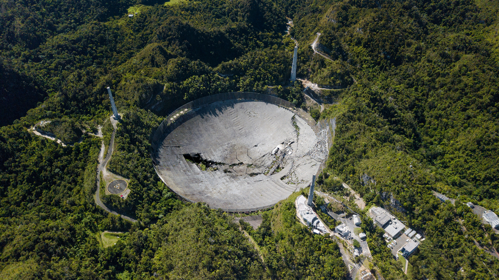
The Arecibo Observatory was built in 1963 and was the largest single-aperture radio telescope in the world at the time. Its massive size and advanced technology made it the perfect tool for mapping the surface of Venus. Scientists had long been interested in learning more about the planet, which was known to have a thick atmosphere that prevented visible light from reaching its surface.
In 1973, the National Aeronautics and Space Administration (NASA) and the National Science Foundation (NSF) partnered with the Arecibo Observatory to begin the Venus Radar Mapping project. The project involved beaming powerful radio waves from the Arecibo radio telescope towards Venus, with the waves reflecting off the planet’s surface and returning to the telescope. By analyzing the returned signals, scientists were able to create a detailed map of the planet’s surface.
The Venus Radar Mapping project was groundbreaking in many ways. It was the first time that a planetary surface had been mapped using radar, and the first time that scientists were able to penetrate the thick atmosphere of Venus to see its surface. The data collected by the project showed that Venus has a highly varied surface, with mountainous regions, large impact craters, and vast volcanic plains. The radar mapping also revealed evidence of active volcanism on Venus, which was a surprising discovery given the planet’s distance from the sun.
The Venus Radar Mapping project was a major scientific accomplishment and paved the way for further research into the inner planets of our solar system. It also helped to solidify the Arecibo Observatory’s reputation as one of the world’s leading centers for radio astronomy and planetary science. The observatory continued to make important contributions to our understanding of the universe for many years to come, until its closure in 2020 due to structural concerns.
Today, the legacy of the Venus Radar Mapping project lives on through the valuable scientific data it provided and the advancements it inspired in the field of planetary science. With the increasing capabilities of new space missions and observatories, scientists are able to build upon the work of the project and further explore the mysteries of our solar system.
For example, the Magellan spacecraft, which was launched by NASA in 1989, used radar to map the surface of Venus and gather information about the planet’s geology and topography. This mission confirmed and expanded upon the findings of the Venus Radar Mapping project, and provided new insights into the history and evolution of Venus.
The legacy of the Arecibo Observatory, where the Venus Radar Mapping project was conducted, also continues to inspire new generations of scientists and engineers. The observatory was a remarkable feat of engineering and its unique capabilities made it a crucial tool in the advancement of planetary science and radio astronomy.
However, despite its significance, the Arecibo Observatory was decommissioned in 2020 due to safety concerns related to the structural integrity of its massive radio telescope. This marked the end of an era for the observatory, but its legacy lives on through the important scientific contributions it made over the years.
In conclusion, the Venus Radar Mapping project of 50 years ago remains an important chapter in the history of planetary science. The data it provided and the advancements it inspired continue to shape our understanding of the solar system and beyond. The Arecibo Observatory may no longer be operational, but its legacy lives on through the scientific knowledge it helped to generate.


